
This is the vegetation line to the North by Japanese School.
.jpg)
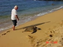
This is the vegetation line to the West end of the property by the 5 acre vacant lot fronting the BarBQ area. Centering this area the distance from the rock wall to the Left and Right mark between the two vegetation lines is 42 feet.
Hawaii Supreme Court Reaffirms Definition of Shoreline
Diamond v. State, 2006 Haw. LEXIS 559 (Haw. Oct. 24, 2006).
Terra Bowling, J.D.

Here is our property layout including dimensions that are filed with the State.
Two Hawaiian residents contested a property owner’s shoreline certification that had been based on artificially introduced vegetation and resulted in the shoreline moving closer to the ocean, possibly restricting public access and contributing to beach erosion. In October, the Supreme Court of Hawaii ruled in favor of the residents, confirming the correct definition of “shoreline” for construction setback purposes.
Background
In 1999, Carl Stephens purchased an oceanfront lot in a subdivision on the island of Kauai. Shortly after buying the property, Stephens replaced large false kamani trees along the shoreline with spider lilies and naupaka and had an irrigation line installed to water the vegetation.
Before beginning new construction on beachfront property in Hawaii, the Department of Land and Natural Resources (DLNR) must approve a shoreline certification, which county zoning boards then use to determine the construction setback. Stephens obtained a shoreline certification from the DLNR placing the shoreline along the high-water mark; however, the certification expired before Stephens could begin construction.
In a second survey, state inspector Randall Hashimoto placed the shoreline at the vegetation line Stephens had planted despite rejecting the naupaka as a shoreline marker in the first survey. The new certification placed the shoreline more than ten feet seaward at some points.
After the shoreline was certified by the DLNR, Harold Diamond and Caren Bronstein filed an administrative appeal with the Board of Land and Natural Resources (BLNR), which was denied. Diamond and Bronstein appealed the BLNR’s denial of appeal to the Fifth Circuit Court of Hawaii. The court affirmed the BLNR’s order noting that the BLNR had revised its definition of “shoreline” to reflect the legislature’s definition.
Mootness
Prior to June 2006, the Board of Land and Natural Resources (BLNR) definition of shoreline contrasted with the Hawaii State Legislature’s definition of shoreline. The legislature defines shoreline as “the upper reaches of the wash of the waves … usually evidenced by the edge of vegetation growth, or the upper limit of debris left by the wash of the waves.”1 The BLNR defined shoreline as “the upper reaches of the wash of the waves … usually evidenced by the edge of vegetation growth, or where there is no vegetation in the immediate vicinity, the upper limit of debris left by the wash of the waves.”2 The BLNR definition seemed to give a preference for using the vegetation line for shoreline certification.
Amid much controversy, the BLNR revised its definition of shoreline to reflect the wording used by the legislature. The Hawaii Supreme Court agreed that the issue of shoreline delineation was moot, as there were no longer conflicting definitions and the court could not provide an effective remedy. The court noted, however, that it would decide moot issues in “cases involving questions that affect the public interest and are ‘capable of repetition yet evading review.’”3 In this instance, the court concluded that the definition of shoreline was “a matter of vast public importance” and that future shoreline certification challenges were likely; therefore, it would rule on the claim despite its mootness.
Defining Shoreline
The court found that a previous Hawaii Supreme Court decision, County of Hawaii v. Somatura, supported the proposition that “the shoreline should be certified at the highest reach of the highest wash of the waves.”4 In Somatura, the court held that public policy supported “extending to public use and ownership as much of Hawaii’s shoreline as is reasonably possible.”5 The court also examined legislative history of HRS § 205A-1 and found that it favored shoreline certification at the highest reach of the highest wash of the waves.
In examining whether to use the vegetation line or the debris line when determining the upper reaches of the wash of the waves, the court examined both the language and the legislative history of the statute. The court held that there is no preference for which line to use when determining the highest reach of the waves, so long as the line used is the one farthest inland.
Diamond and Bronstein also raised the issue of whether a vegetation line that had been planted and irrigated by property owners could be used to determine the shoreline. The BLNR defines vegetation growth as “any plant, tree, shrub, grass or groups, clusters, or patches of the same, naturally rooted and growing.”6 The court found that, although the agency’s interpretation of its rule should be given weight, it “encourages private landowners to plant and promote salt-tolerant vegetation to extend their land [farther seaward]” and did not comply with the legislative purpose of extending public use and ownership of the shoreline.7
Conclusion
The Hawaii Supreme Court reversed the circuit court’s ruling and clarified the shoreline certification process; however, the court’s decision will not have an effect on Stephens’ property. Prior to the ruling, Stephens sold the property and the current owner began construction using the now-defunct shoreline certification.8
Endnotes
1. Haw. Rev. Stat. § 205A-1.
2. Haw. Code R. § 13-222-2.
3.Diamond v. State, 2006 Haw. LEXIS 559 at *29 (Hawaii Oct. 24, 2006).
4. Id. at *34.
5. Id. .
6. Haw. Code R. § 13-222-2.
7. Diamond, 2006 Haw. LEXIS 559 at *43.
8. http://the.honoluluadvertiser.com/article/ 2006/Oct/26/ln/FP610260344.html .
PART I. COASTAL ZONE MANAGEMENT
Note
Former Part I, Long Range Goals, §§205A-1 to 3, repealed by L 1977, c 188, §2.
§205A-1 Definitions. As used in this chapter, unless the context otherwise requires:
"Agency" means any agency, board, commission, department, or officer of a county government or the state government, including the authority as defined in part II;
"Artificial light" or "artificial lighting" means the light emanating from any fixed human-made device.
"Coastal zone management area" means all lands of the State and the area extending seaward from the shoreline to the limit of the State's police power and management authority, including the United States territorial sea;
"Coastal zone management program" means the comprehensive statement in words, maps, or other permanent media of communication, prepared, approved for submission, and amended by the State and approved by the United States government pursuant to Public Law No. 92-583, as amended, and the federal regulations adopted pursuant thereto, which describes objectives, policies, laws, standards, and procedures to guide and regulate public and private uses in the coastal zone management area, provided however the "coastal zone management program" is consistent with the intent, purpose, and provisions of this chapter;
"Directly illuminate" means to illuminate through the use of a glowing element, lamp, globe, or reflector of an artificial light source.
"Land" means the earth, water, and air above, below, or on the surface;
"Lead agency" means the office of planning;
"Ocean waters" means all waters seaward of the shoreline within the jurisdiction of the State.
"Person" means an individual, corporation, or partnership, and an organization or association, whether or not incorporated;
"Public advisory body" means the advisory body established in section 205A-3.5;
"Shoreline" means the upper reaches of the wash of the waves, other than storm and seismic waves, at high tide during the season of the year in which the highest wash of the waves occurs, usually evidenced by the edge of vegetation growth, or the upper limit of debris left by the wash of the waves. [L 1977, c 188, pt of §3; am L 1979, c 200, §1; am L 1983, c 124, §7; am L 1986, c 258, §2; am L 1987, c 336, §7; am L 1988, c 352, §4; am L 1989, c 356, §4; am L 1990, c 126, §7; am L 1993, c 91, §2; am L 1995, c 104, §4; am L 1996, c 299, §3; am L 2001, c 169, §2; am L 2005, c 224, §3]
Case Notes
In the definition of "shoreline", the "upper reaches of the wash of the waves" is the highest reach of the highest wash of the waves in non-storm or tidal conditions, "usually evidenced by the edge of vegetation growth"; merely because artificially planted vegetation survives more than one year does not deem it "naturally rooted and growing" such that it can be used to determine the shoreline. 112 H. 161, 145 P.3d 704.
Previous Vol04_Ch0201-0257 Next
No comments:
Post a Comment